“A city’s environment is shaped not only by people who have an important influence, but by everyone who lives or works there.”
- Robert Cowen
Dr Davood Shojaei

Dr. Davood Shojaei is a Senior Lecturer in the Department of Infrastructure Engineering at the University of Melbourne, where he also leads the Digital Lab, driving innovative solutions for both academia and industry.
With 20 years of experience in research and development, Dr. Shojaei is a recognized leader in the fields of GIS, cadastre, BIM, and 3D visualization.
Dr. Shojaei's extensive portfolio includes the design and implementation of diverse research and industry projects, showcasing his ability to bridge the gap between cutting-edge technology and practical applications. His work has led to the development of innovative methods and tools that have been adopted across various sectors.
Internationally, Dr. Shojaei has held numerous roles across academia and the public sector, where he has been instrumental in launching advanced technologies and creating innovative methodologies. He previously served on the Academic Board of the Surveyors Registration Board of Victoria, further solidifying his reputation as a thought leader in his field.
Dr. Shojaei holds a PhD in 3D Cadastre Visualization from the University of Melbourne and is a subject matter expert in 3D visualization for the land and property sector. His passion for innovation is evident in his teaching, where he coordinates and instructs subjects including Sensing and Measurement, as well as Information Visualization. Through these subjects, he introduces students to the latest technologies, equipping them with advanced data capture and visualization skills.
With a deep network of industry connections across the private and public sectors, both locally and globally, Dr. Shojaei leverages his relationships with trusted advisors and business colleagues to stay at the forefront of technological advances. His work consistently focuses on delivering commercial value through research and development, ensuring that his contributions have a tangible impact on industry practices.
Dr Shojaei has been honored with several prestigious awards, including the Geospatial Excellence Award as the Oceanic Winner for Educational Development from the Geospatial Council of Australia, in recognition of his exceptional contributions to teaching and mentoring in Geomatics. He has also secured numerous grants from both government and industry for his innovative projects.
Research Opportunities
There are PhD Positions available for talented candidates to participate in research in the following topics:
- 3D Visualization (Mixed Reality/Virtual Reality)
- Computer Vision and Spatial AI
If you are interested in these areas, please send your CV and transcripts to
shojaeid@unimelb.edu.au
Research Highlights
-
5G mmWave network planning and customer service qualification using ray-tracing
As the world grows to become exceedingly interconnected, technological advancements in spatial communication such as 5G have had to speed up as well. This is a research project with Telstra to facilitate 5G modelling in urban areas using Digital Twin.
-
ePlanning and eApprovals Project
Planning and building approval processes are still largely paper based, which make them inefficient and time-consuming, imposing significant costs on both industry and government. We aim to embrace the opportunities that digital workflow and digital twin technology provide to design, develop and deliver an innovative digital platform to facilitate effective, efficient and timely planning, building permits, approvals.
-
Detection and capturing of street pole positions from imagery using Artificial Intelligence
Mobile network deployment at mmWave frequencies (>20GHz) faces various challenges because of high signal attenuation and susceptibility to blockage due to obstructions (buildings, foliage etc). To meet the LOS or near-LOS conditions, the base stations need to be mounted on street poles or other types of street furniture to be closer to end users. Therefore, an accurate, low-cost and automated approach for detecting and capturing street pole positions for any locality is of significant importance and in high demand.
Research Areas
Grants & Awards
| Year | Grant Name / Award |
|---|---|
| 2024 | RIIF Collaborative Equipment Grant 2024, The University of Melbourne |
| 2024 | Geospatial Excellence Award - Educational Development, Oceanic Winner, Geospatial Council of Australia |
| 2023 | The Faculty of Engineering and Information Technology (FEIT) Excellence Awards - Teaching and Learning for Early Career Academics, the University of Melbourne |
| 2023 | CIS-IE 2023 Seed Funding - Using Artificial Intelligence to detect and extract underground utilities from Ground Penetrating Radar (GPR) images, The University of Melbourne |
| 2023 | Sprint Research Grants - 5G mmWave Network Planning Tool, Telstra / The University of Melbourne |
| 2023 | Geospatial Excellence Award - Educational Development, Victorian Award, Geospatial Council of Australia |
| 2023 | ABP-FEIT Research Collaboration Development Grant, the University of Melbourne |
| 2023 | Sprint Research Grants - Detection and Capturing of Street Assets Using Artificial Intelligence, Telstra / The University of Melbourne |
| 2023 | Major Teaching and Learning Infrastructure Funding, The University of Melbourne |
| 2022 | ARC Discovery Project, A digital twin framework for human mobility measurement in the home setting, 2023-2025, the University of Melbourne. |
| 2022 | Research Initiatives Fund (RIF) Collaborative Equipment Grant, the University of Melbourne. |
| 2022 | FEIT Visiting Academic Fellows Scheme, the University of Melbourne. |
| 2022 | Telstra Sprint Research Grant to contribute to Telstra's 5G rollout and effective small cell placement / deployment. |
| 2021 | Special Recognition Award from the School of EMI, The University of Melbourne. This is in recognition of a team work in reimagining Geomatics education and developing new programs in Digital Infrastructure Engineering. |
| 2021 | Dyason Fellowships - The integration of 3D cadastre and planning approval processes to facilitate urban development, The University of Melbourne |
| 2021 | Early Career Researcher Grant - Mobile Crowdsourcing for High‐Quality Base Maps, The University of Melbourne |
| 2021 | Major Teaching and Learning Infrastructure Funding, The University of Melbourne |
| 2021 | Outstanding Paper in 3D Modelling, City 3D CITYLUR: Modelling 3D Land-Use Regulations to Support Issuing a Planning Permit, 3D GeoInfo Conference New York |
| 2021 | Dual-delivery Contribution Grant, The University of Melbourne |
| 2021 | Mitacs - Land-use regulation modelling and conflicts detection in 3D city models: A proof of concept based on Bentley software solutions (3D CityLuR) with Laval University, Canada |
| 2021 | Lead CI, FEIT Interdisciplinary Grant - Empowering Mixed Reality with Artificial Intelligence for Damage Assessment in Large Infrastructures, The University of Melbourne |
| 2021 | Lead CI, Research grant - 5G mmWave network planning and customer service qualification using ray-tracing, Telstra |
| 2021 | Lead CI, ePlanning and eApprovals Project, CRC Building 4.0 |
| 2020 | Department Award for Outstanding work in Teaching and Research (Dept. of Infrastructure Engineering) |
| 2019 | MSE Strategic Investment Fund (UoM) |
| 2019 | Travel Grant to attend the World Urban Forum in Abu Dhabi |
| 2013 | Elected Student Member (The Institution of Surveyors Victoria, Australia) |
| 2012 | Award for Best Paper Presentation at Post Graduate Conference (UoM) |
| 2010 | Melbourne International Research Scholarship (MIRS) |
| 2010f | Melbourne International Fee Remission Scholarship (MIFRS) |
| 2009 | 2 Full Scholarships - Erasmus Mendus Scholarship (European Commission) |
Showcase Videos
|
|
|
|
|
|
|
|
|
|
|
|
|
|
Research Partners and Collaborators
Research Publications
Journal Publications
28. Interactive Mixed Reality Methods for Visualization of Underground Utilities, PFG – Journal of Photogrammetry, Remote Sensing and Geoinformation Science,
Abdul Muthalif, M.Z., Shojaei, D., Khoshelham, K. 2024.
Link
27. Automated land valuation models: A comparative study of four machine learning and deep learning methods based on a comprehensive range of influential factors, Cities,
Jafary, P., Shojaei, D., Rajabifard, A., Ngo, T. 2022.
Link
26. Automating property valuation at the macro scale of suburban level: A multi-step method based on spatial imputation techniques, machine learning and deep learning, Habitat International,
Jafary, P., Shojaei, D., Rajabifard, A., Ngo, T. 2022.
Link
25. Enhancing Healthcare through Sensor-Enabled Digital Twins in Smart Environments: A Comprehensive Analysis, Sensors,
Adibi, S., Rajabifard, A., Shojaei, D., Wickramasinghe, N. 2024
Link
24. A conceptual framework for automatic modelling and conflict detection of 3D land-use regulation restrictions to support issuing planning permits, Land Use Policy,
Emamgholian, S., Pouliot, J., Shojaei, D. 2024.
Link
23. Undertaking land administration reform: Is there a better way?, Land Use Policy,
Burns, A.F., Rajabifard, A., Shojaei, D. 2023.
Link
22. Urban 5G MmWave Networks: Line-of-Sight Probabilities and Optimal Site Locations, Journal of Telecommunications and the Digital Economy,
Han, T., Shojaei, D., Fitzpatrick, P., Sakurai, T., Evans, J. 2023.
Link
21. BIM and real estate valuation: challenges, potentials and lessons for future directions, Engineering, Construction and Architectural Management,
Jafary, P., Shojaei, D., Rajabifard, A., Ngo, T. 2022.
Link
20. A review of augmented reality visualization methods for subsurface utilities, Advanced Engineering Informatics,
Muthalif, MZA., Shojaei, D., Khoshelham, K. 2022.
Link
19. Requirements of a data storage infrastructure for effective land administration systems: case study of Victoria, Australia, Journal of Spatial Science,
Shojaei, D., Badiee, F., Olfat, H., Rajabifard, A., Atazadeh, B. 2022.
Link
18. A Proposal for Streamlining 3D Digital Cadastral Data Lifecycle, Land,
Olfat, H., Atazadeh, B., Badiee, F., Chen, Y., Shojaei, D., Rajabifard, A. 2021.
PDF
17. Integration of Cadastral Survey Data into Building Information Models, Geo-spatial Information Science,
Atazadeh, B., Halalkhor Mirkalaei, L., Olfat, H., Rajabifard, A., Shojaei, D. 2021.
Link
16. Spatial-Temporal Prediction of PM2.5 Pollutants Using Deep Recurrent Networks: A Case Study of Tehran, Journal of Geomatics Science and Technology,
Faraji, M., Nadi, S., Shojaei, D. 2021.
PDF
15. Linking Land Administration Domain Model and BIM environment for 3D digital cadastre in multi-storey buildings, Land Use Policy,
Atazadeh, B., Olfat, H., Rajabifard, A., Kalantari, M., Shojaei, D., Mesbah Marjani, A. 2021.
Link
14. Design and Development of an LADM-driven 3D Land Administration System: Lessons Learned in Malaysia, Land Use Policy,
Rajabifard, A., Atazadeh, B., Kalantari, M., Olfat, H., Shojaei, D., Badiee, F. 2021.
Link
13. Moving Towards a Single Smart Cadastral Platform in Victoria, Australia, ISPRS International Journal of Geo-Information,
Olfat, H., Atazadeh, B., Rajabifard, A., Mesbah, A., Badiee, F., Chen, Y., Shojaei, D., Briffa, M. 2020.
PDF
12. Exploring the applications of 3D proximity analysis in a 3D digital cadastre, Geo-spatial Information Science,
Emamgholian, S., Taleai, M., Shojaei, D. 2020.
PDF
11. The Feasibility of a BIM-Driven Approach to Support Building Subdivision Workflows—Case Study of Victoria, Australia, ISPRS International Journal of Geo-Information,
Olfat, H., Atazadeh, B., Shojaei, D., Rajabifard, A. 2019.
PDF
10. Utilizing BIM environment to communicate the legal ownership of IoT generated data in multi-owned buildings, Electronics,
Atazadeh, B., Olfat, H., Rismanchi, B., Shojaei, D., Rajabifard, A. 2019.
PDF
9. Accuracy Assessment of DEMs in Different Topographic Complexity Based on an Optimum Number of GCP Formulation and Error Propagation Analysis, Journal of Surveying Engineering,
Nadi, S., Shojaei, D., Ghiasi, Y. 2019.
PDF
8. Tackling the Challenges of Visualising Digital Cadastral Plans: The Victorian Cadastre Experience, Land Use Policy,
Olfat, H., Jani, A., Shojaei, D., Darvill, A., Badiee, F., Rajabifard, A., Briffa, M. 2019.
Link
7. Design and Development of a 3D Digital Cadastre Visualization Prototype, ISPRS International Journal of Geo-Information,
Shojaei, D., Olfat, H., Rajabifard, A., Briffa, M. 2018.
PDF
6. Strategic Actions for Increasing the Submission of Digital Cadastral Data by the Surveying Industry Based on Lessons Learned from Victoria, Australia, ISPRS International Journal of Geo-Information,
Olfat, H., Shojaei, D., Briffa, M., Maley, S., Rajabifard, A. 2018.
PDF
5. Geometrical data validation in 3D digital cadastre − A case study for Victoria, Australia, Land Use Policy,
Shojaei, D., Olfat, H., Quinones Faundez, S., Kalantari, M., Rajabifard, A., Briffa, M. 2017.
PDF
4. Assessment of the Australian digital cadastre protocol (ePlan) in terms of supporting 3D building subdivisions, Land Use Policy,
Shojaei, D., Olfat, H., Rajabifard, A., Darvill, A., Briffa, M. 2016.
Link
3. Integrating legal and physical dimensions of urban environments, ISPRS International Journal of Geo-Information,
Aien, A., Rajabifard, A., Kalantari, M., Shojaei, D. 2015.
PDF
2. Design and Development of a Web-based 3D Cadastral Visualisation Prototype, International Journal of Digital Earth,
Shojaei, D., Rajabifard, A., Kalantari, M., Bishop, I., and Aien, A. 2014.
PDF
1. Visualization requirements for 3D cadastral systems, Computers, Environment and Urban Systems,
Shojaei, D., Kalantari, M., Bishop, I., Rajabifard, A., Aien, A. 2013.
Link
Book Chapters
3. Modernizing Land Administration Systems to Support Sustainable Development Goals - Case Study of Victoria, Australia, In Sustainable Development Goals Connectivity Dilemma, Rajabifard, A., Ed.; CRC Press: Boca Raton, pp. 325-336,
Olfat, H., Shojaei, D. 2019.
Link
2. Visualization and New Opportunities, In Best Practices 3D Cadastres - Extended version, Oosterom, P.V., Ed.; International Federation of Surveyors (FIG): Copenhagen, Denmark, pp. 183-230,
Pouliot, J., Ellul, C., Hubert, F., Wang, C., Rajabifard, A., Kalantari, M., Shojaei, D., Atazadeh, B., Van Oosterom, P., De Vries, M., Ying, S. 2018.
Link
1. 3D Visualisation as a Tool to Facilitate Managing Land and Properties, In A National Infrastructure for Managing Land Information, Rajabifard, A., Williamson, I., Kalantari, M., Eds.; The University of Melbourne, pp. 88-94,
Shojaei, D. 2012.
PDF
Refereed Conferences
29. Exploring Spatial Interaction and Visualization Paradigms for 3D Cadastral Visualization, ISPRS Ann. Photogramm. Remote Sens. Spatial Inf. Sci., X-4/W5-2024,
Meliana, I., Hajji, R. & Shojaei, D. 2024.
Link
28. Pole-NN: Few-Shot Classification of Pole-Like Objects in Lidar Point Clouds, ISPRS Ann. Photogramm. Remote Sens. Spatial Inf. Sci., X-4/W5-2024,
Zhang, Z., Khoshelham, K. & Shojaei, D. 2024.
Link
27. Iso 19650.3 and the Digitisation of Operations in Strata-Titled Residential Apartment Developments, 2023 IOP Conf. Ser.: Earth Environ. Sci (EES), Conference on Facility Management and Maintenance 2023 (CIB W070), 8-11 May 2023, Trondheim, Norway,
Tanfield, K., Heywood, C., Warren-Myers, G., Kalantari, M., Shojaei, D. 2023.
PDF
26. A Framework To Integrate BIM with Artificial Intelligence and Machine Learning-based Property Valuation Methods, ISPRS Annals of the Photogrammetry, Remote Sensing and Spatial Information Sciences, Volume X-4/W2-2022, 17th 3D GeoInfo Conference, 19–21 October 2022, Sydney, Australia,
Jafary, P., Shojaei, D., Rajabifard, A., Ngo, T. 2022.
PDF
25. A Web-based Planning Permit Assessment Prototype: ITwin4PP, The International Archives of the Photogrammetry, Remote Sensing and Spatial Information Sciences, Volume XLVIII-4/W4-2022, 17th 3D GeoInfo Conference, 19-21 October 2022, Sydney, Australia,
Emamgholian, S., Pouliot, J., Shojaei, D., Losier, L.M. 2022.
PDF
24. Resolving perceptual challenges of visualising underground utilities in mixed reality, The International Archives of the Photogrammetry, Remote Sensing and Spatial Information Sciences, Volume XLVIII-4/W4-2022, 17th 3D GeoInfo Conference, 19-21 October 2022, Sydney, Australia,
Muthalif, M.Z.A., Shojaei, D., Khoshelham, K. 2022.
PDF
23. 3D Zoning: A Missing Piece to Link Planning Regulations with 3D Cadastre, 7th International FIG Workshop on 3D Cadastre 11-13 October 2021, New York, USA,
Emamgholian, S., Pouliot, J., Shojaei, D. 2021.
PDF
22. 3D CityLUR: Modelling 3D City Land-Use Regulations to Support Issuing a Planning Permit, ISPRS Ann. Photogramm. Remote Sens. Spatial Inf. Sci., VIII-4/W2-2021, 113–120,
Emamgholian, S., Pouliot, J., Shojaei, D. 2021.
PDF
21. Modelling Land-Use Regulation Conflicts With 3D Components to Support Issuing a Building Permit, The International Archives of the Photogrammetry, Remote Sensing and Spatial Information Sciences, Volume XLIV-4/W1-2020, 2020 3rd BIM/GIS Integration Workshop and 15th 3D GeoInfo Conference, 7–11 September 2020, London, UK,
Emamgholian, S., Pouliot, J., Shojaei, D. 2020.
PDF
20. Utilising Virtual and Augmented Reality Technologies to Improve the Visualisation of Digital Cadastre—The Victorian Cadastre Experience. In Proceedings of the 2nd International IAG Workshop on BIM and GIS Integration, 3D GeoInfo Conference 2019, Singapore,
Shojaei, D., Olfat, H., Aien, A., Nimorakiotakis, N., Rajabifard, A. 2019.
Link
19. Moving Towards a Fully Operational 3D Digital Cadastre: Victoria, Australia, FIG 3D Cadastres workshop 2018, Delft, Netherlands,
Shojaei, D., Olfat, H., Rajabifard, A., Kalantari, M., Briffa, M. 2018.
PDF
18. An Overview of the Victorian 3D Digital Cadastre Roadmap, International Symposium on A Smart Sustainable Future for All – Enhancing Resilience in a Changing Landscape 24 – 26 September 2017, The University of Melbourne, Australia,
Olfat, H., Shojaei, D., Rajabifard, A., Briffa, M. 2018.
PDF
17. An LADM-based Approach for Developing and Implementing a National 3D Cadastre – A Case Study of Malaysia, 7th International FIG Workshop on the Land Administration Domain Model 11-13 April 2018, Zagreb, Croatia,
Rajabifard, A., Agunbiade, M., Kalantari, M. Yip,. K., Atazadeh, B., Badiee, F., Isa, D., Adimin, M., Chan, K., Aien, A., Olfat, H., Shojaei, D., Anaraki, M. 2018.
PDF
16. A Novel Approach For 3D Neighbourhood Analysis, International Archives of the Photogrammetry, Remote Sensing & Spatial Information Sciences, ISPRS Geospatial Week 2017, 18–22 September 2017, Wuhan, China,
Emamgholian, S., Taleai, M., Shojaei, D. 2017.
PDF
15. The Current Status and Ongoing Investigations of 2D and 3D Digital Cadastre (ePlan) in Victoria, Australia, 10th International Symposium on Digital Earth & Locate17,
Olfat, H., Shojaei, D., Briffa, M., and Rajabifard, A. 2017.
PDF
14. 3D Digital Cadastre Journey in Victoria, Australia, ISPRS Ann. Photogramm. Remote Sens. Spatial Inf. Sci., IV-4/W5, 117-123,
Shojaei, D., Olfat, H., Briffa, M., Rajabifard, A. 2017.
PDF
13. The Victorian Digital Cadastre: Challenges and Investigations, Locate 16, Melbourne Australia,
Olfat, H., Shojaei, D., Briffa, M. 2016.
PDF
12. Review and Assessment of Current Cadastral Data Models for 3D Cadastral Applications, the XXV International FIG Congress, Kuala Lumpur, Malaysia,
Aien, A., Rajabifard, A., Kalantari, M., Williamson, I., and Shojaei, D. 2014.
PDF
11. 3D Cadastre: A Multifaceted Challenge, Proceeding of the FIG Congress 2014, Kuala Lumpur, Malaysia,
Rajabifard, A., Williamson, I., Marwick, B., Kalantari, M., Ho, S., Shojaei, D., Atazadeh, B., Amirebrahimi, S., Jamshidi, A. 2014.
PDF
10. Development of XML Schemas for Implementation of a 3D Cadastral Data Model, Proceedings of 4th International FIG 3D Cadastre Workshop, Dubai, UAE,
Aien, A., Rajabifard, A., Kalantari, M., Williamson, I., Shojaei D. 2014.
PDF
9. Development of a 3D ePlan LandXML Visualisation System in Australia, 3rd International Workshop on 3D Cadastres: Developments and Practices, 25-26 October 2012, Shenzhen, China,
Shojaei, D., Rajabifard, A., Kalantari, M., Bishop, I., Aien, A. 2012.
Link
8. Developing and Testing a 3D Cadastral Data Model- A Case Study in Australia, ISPRS Annals of Photogrammetry, Remote Sensing and the Spatial Information Sciences. Volume I-4, pp.1-6, Melbourne, Australia,
Aien, A., Kalantari, M., Rajabifard, A., Williamson, I., Shojaei, D. 2012.
PDF
7. Spatially Enabling Isfahan Metropolis through Local SDI, GSDI 12 World Conference, Singapore,
Adili E., Golestannejad A., Heidarian V., Amini M., Sadeghi M., Shojaei, D., Rajabifard A. 2010.
TBC
6. Using of Panorama Images in Developing of Tourism Industry, ICT and Development of Tourism Industry Conference, Isfahan, Iran,
Shojaei, D., Ataee, S. 2007.
TBC
5. Triangulation for Surface Modelling, 9th Symposium on the 3-D Analysis of Human Movement, Valenciennes, France,
Shojaei, D., Helali, H., Alesheikh, A.A. 2006.
PDF
4. Evaluation of DTM Generation in SURFER 8.0, Map India 2006, New Delhi, India,
Hamrah, M., Shojaei, D., Mosavi, A. 2006.
PDF
3. Evaluation the Methods of Triangulation and Effective Parameters, Geomatics 84 Exhibition and Conference, National Cartography Centre, Tehran, Iran,
Varshosaz, M., Helali, H., Shojaei, D. 2005.
2. The Methods of Triangulation, Map Middle East 2005, 1st Annual Middle East Conference and Exhibition on Geospatial Information, Technology and Applications, Dubai, UAE,
Varshosaz M., Helali, H., Shojaei, D. 2005.
PDF
1. Using GIS and Application for Tourism, Map Middle East 2005, 1st Annual Middle East Conference and Exhibition on Geospatial Information, Technology and Applications, Dubai, UAE,
Shojaei, D. 2005.
PDF
Other Publications
Magazine Articles
3. 3D Visualisation of Cadastres, Traverse,
Shojaei, D., Rajabifard, A., Kalantari, M., Bishop, I. 2013.
PDF
2. Time to Visualise Cadastre in 3D, Geospatial Today,
Shojaei, D., Rajabifard, A. 2013.
1. 3D Cadastre in Victoria, Converting Building Plans of Subdivision to LandXML, GIM International,
Aien, A., Rajabifard, A., Kalantari, M., Williamson, I., Shojaei, D. 2011.
Link
-
National Geospatial Excellence Award winners 2023/2024
Dr Davood Shojaei was awarded the 2023/2024 Geospatial Excellence Award for Educational Development (Oceanic Winner) from the Geospatial Council of Australia.
-
The Faculty of Engineering and Information Technology (FEIT) Excellence Awards
Dr Davood Shojaei was awarded the 2023 FEIT Excellence Awards in Teaching and Learning for Early Career Academics.
-
CIS-IE seed funding outcomes
Dr Kris Ehinger from the School of Computing and Information Systems (CIS) and Dr Davood Shojaei from the Department of Infrastructure Engineering (IE) have been announced as recipients of the CIS-IE 2023 Seed Funding round. They will be conducting a project focused on “Using Artificial Intelligence to detect and extract underground utilities from Ground Penetrating Radar (GPR) images”.
-
Telstra and University of Melbourne on the crest of 5G wave
A key research project between the University of Melbourne and Telstra has developed a prototype tool to automate some steps in cell planning, with the potential to accelerate Telstra’s network planning process for 5G small cells.
-
2023 Victorian Geospatial Excellence Award winners
Dr Davood Shojaei was awarded the 2023 Victorian Geospatial Excellence Award for Educational Development.
Current Projects
-
A Digital Twin Framework for Human Mobility Measurement in the Home Setting
Project Party
ARC
The University of Melbourne
The objective of this Discovery Project is to develop the "Digital Twin", a digital replica of a person moving in real-time within a 3D digital render of their own living environment. This technology, which will be supported by advanced deep neural networks, will facilitate accurate measurement of joint angles, as well as identification of motor tasks and task performance continuously over extended periods of weeks or months. Deployed on an iPad, the Digital Twin will allow a person, without any technical expertise, to use wearable technology to collect accurate and robust mobility data independently and with ease in almost any location. Integrating the 3D living environment with human movement data has not been achieved to date and will provide next-level human movement visualisation capability. It will extend our understanding of how individuals move within their home (beyond conventional clinical joint motion assessment), by revealing what tasks individuals do and how, as they physically interact with their own living space.
-
Detection and capturing of street pole positions from imagery using Artificial Intelligence
Project Party
Telstra
The University of Melbourne
Mobile network deployment at mmWave frequencies (>20GHz) faces various challenges because of high signal attenuation and susceptibility to blockage due to obstructions (buildings, foliage etc). To meet the LOS or near-LOS conditions, the base stations need to be mounted on street poles or other types of street furniture to be closer to end users. Hence, accurate data on the configuration and locations of candidate poles is critical for the mmWave network planning process. Yet, the quality of this asset data is highly variable. Moreover, the network operator needs to enter into commercial arrangements with one or more utility companies even before initial strategic planning can commence. Therefore, an accurate, low-cost and automated approach for detecting and capturing street pole positions for any locality is of significant importance and in high demand.
-
Using Artificial Intelligence to detect and extract underground utilities from Ground Penetrating Radar (GPR) images
Project Party
The University of Melbourne
This project aims to use Artificial Intelligence (Deep-Learning) and computer vision to detect underground utilities by interpreting images produced by Ground Penetrating Radar (GPR). Any development project that involves excavation requires mapping out existing underground utilities so that they can be avoided. Without an accurate map, excavators run the risk of damaging underground utilities. This project will use state-of-the-art computer vision techniques to automatically detect underground assets in GPR imagery.
Completed Projects
-
Mobile Crowdsourcing for High-Quality Base Maps
Project Party
The University of Melbourne
Base maps are a fundamental infrastructure that users rely on to make decisions for a range of applications such as town planning and designing major infrastructures. However, the spatial accuracy and availability of base maps are still a global challenge as 75% of the world’s ownership boundaries are not registered in base maps. Therefore, there is a significant demand and challenge for developing affordable technologies for updating base maps. This project aims to develop an innovative and affordable method to capture ownership boundaries using crowdsourcing, Augmented Reality, and highly accurate mobile positioning technology to improve the accuracy of base maps.
-
Empowering Mixed Reality with Artificial Intelligence for Damage Assessment in Large Infrastructures
Project Party
The University of Melbourne
In this project, we aim to develop a Mixed Reality(MR) Application powered by Artificial Intelligence(AI) for use in Infrastructure Damage Assessment. Current damage assessment methods for major infrastructures such as bridges, tunnels are mainly manual, which incur significant costs and is still very dependent on the experts’ experience. This study aims to explore the integration of AI and MR to facilitate the inspection process and assess damages including cracks and spalls in major infrastructures. The state-of-art computer vision technology can improve the consistency and accuracy of the assessment processes. Finally, an application based on HoloLens will be developed, and evaluated.
-
5G mmWave network planning and customer service qualification using ray-tracing
Project Party
Telstra
As the world grows to become exceedingly interconnected, technological advancements in spatial communication such as 5G have had to speed up as well. This is a research project with Telstra and Department of Electrical & Electronic Engineering to investigate signal propagation in urban areas.
-
Land-use regulation modelling and conflicts detection in 3D city models: A proof of concept based on Bentley software solutions (3D CityLuR)
Project Parties
Laval University
The University of Melbourne
Bentley Canada Inc
The applications and understanding of Land-use Regulations (LuR) are more communicable when they are linked to the digital representation of the physical world.In order to support issuing a planning permit and move towards the establishment of automated planning permit checks, this paper investigates how LuRs related to a planning permit process can be modelled in 3D called 3D CityLuR.The showcase is a proof of concept for determining how these LuRs can be modelled in 3D and combined with 3D city models based on the selected geometric modelling approaches, identified parameters, and level of information need.
-
ePlanning and eApprovals Project - Building 4.0 CRC
Project Parties
Lendlease Digital Australia Pty Ltd
uTecture Australia Pty Ltd
Sumitomo Forestry Australia Pty Ltd
A.G.Coombs Group
SFDC Australia Pty Ltd the Australian affiliate of salesforce.com, inc.
The Master Builders Association of Victoria
Victorian Building Authority
Victorian Government, Department of Environment, Land, Water and Planning
Monash University
University of Melbourne
Planning and building approval processes are still largely paper (PDF) based, which make them inefficient and time-consuming, imposing significant costs on both industry and government. Industry is effectively unable to test plan compliance against planning controls and building regulations, track progress of their applications, and efficiently track compliance through construction. The long-term objective of the CRC’s work in this area is to embrace the opportunities that digital workflow and digital twin technology provide to design, develop and deliver an innovative digital platform to facilitate effective, efficient and timely planning, building permits, approvals, ongoing compliance with planning controls, building regulations and other regulatory requirements.
Software
Teaching
Information Visualisation (GEOM90007)
Information Visualisation is about using and designing effective mechanisms for presenting and exploring the patterns embedded in large and complex data sets, and to support decision making. Information Visualisation is important in a range of domains dealing with voluminous data rich in structure, among them, prominently, data in the spatial domain or data referenced to the spatial domain. Through its focus on presentation and interaction with spatial information, this subject complements related subjects that deal with the storage and querying of data (database subjects such as GEOM90018 Spatial Databases), and the processing of data (data analytics subjects such as GEOM90006 Spatial Analysis). This subject is vital for anyone wishing to work with large datasets. It will also be of relevance to those with an interest in design, especially graphical and interaction design.
GEOM90007 Handbook
Sensing and Measurement (GEOM20015)
This subject will introduce students to principles, technologies and procedures used for sensing and measurement of different physical environments and explore how the collected information supports decision making in various applications. This subject explains the theoretical and practical aspects of mapping the physical world to a digital representation. Students will learn the concept of a digital twin, the role of sensing and measuring for connecting the physical world with its digital representations, and exemplary applications of sensing and measuring in the domain of infrastructure engineering. The practical sessions will give hands-on experience with a range of sensing and measurement technologies in a problem-solving context. Students who develop proficiency in the practice of this subject will be able to apply this knowledge in the workplace for capturing and sensing the environment.
GEOM20015 Handbook
Coordinating
Residential Land Development (GEOM90045)
In this subject, students will learn about the land development process, residential subdivision design requirements in Victoria, the subdivision design process, energy efficient subdivisions, planning legislation and environmental controls; the preparation of plans of subdivision and association documentation under the Subdivision Act 1988; and the use of computer-aided design and drafting techniques. This subject is core to students considering a career as a licensed cadastral surveyor and is a requirement for accreditation by the Surveyors Registration Board in Victoria. It complements the knowledge of GEOM90041 Cadastral Surveying and ABPL90041 Property Law, and complements other subjects in the Spatial specialization of the ME (Spatial).
GEOM90045 Handbook
Cadastral Surveying (GEOM90041)
Cadastral surveying relates to the laws of land ownership and the definition of property boundaries and is a core responsibility for the surveying industry and profession. This subject introduces the legal framework of cadastral surveying, the land tenure system in Victoria, and the methods of performing cadastral surveys, including computations and documentation, as it is required for land acquisition, land compensation and land subdivision procedures. This subject builds on students’ knowledge of property law and complements other spatial subjects that can lead to a graduate becoming a licensed surveyor.
GEOM90041 Handbook
Research Assistants
Current PhD Candidates
-
Mojtaba Akhoundi Khezrabad

PhD Candidate
University of Melbourne
-
Nikoo (Fatemeh) Mirhosseini

PhD Candidate
University of Melbourne
-
Cipher (Zezheng) Zhang

PhD Candidate
University of Melbourne
-
Xiaonan Wang

PhD Candidate
University of Melbourne
-
Peyman Jafary

PhD Candidate
University of Melbourne
-
Tony Burns
PhD Candidate
University of Melbourne
-
Karen Tanfield

PhD Candidate
University of Melbourne
-
Zahlan Abdul Muthalif
PhD Candidate
University of Melbourne
Previous Students
-
Saeid Emamgholian

Masters Student, PhD Recipient
Laval University
-
Emily (Yongxin) Ye
Masters Student
University of Melbourne
-
Sebastian Ignacio Quinones Faundez

Masters Student
University of Melbourne
-
Su Chen

Masters Student
University of Melbourne
-
Shrikrishna Sanjay Dere

Masters Student
University of Melbourne
-
Huixuan Chen

Masters Student
University of Melbourne
-
Zhuangzhuang Ma

Masters Student
University of Melbourne
-
Shiming Fan

Masters Student
University of Melbourne
-
Yingying Gong
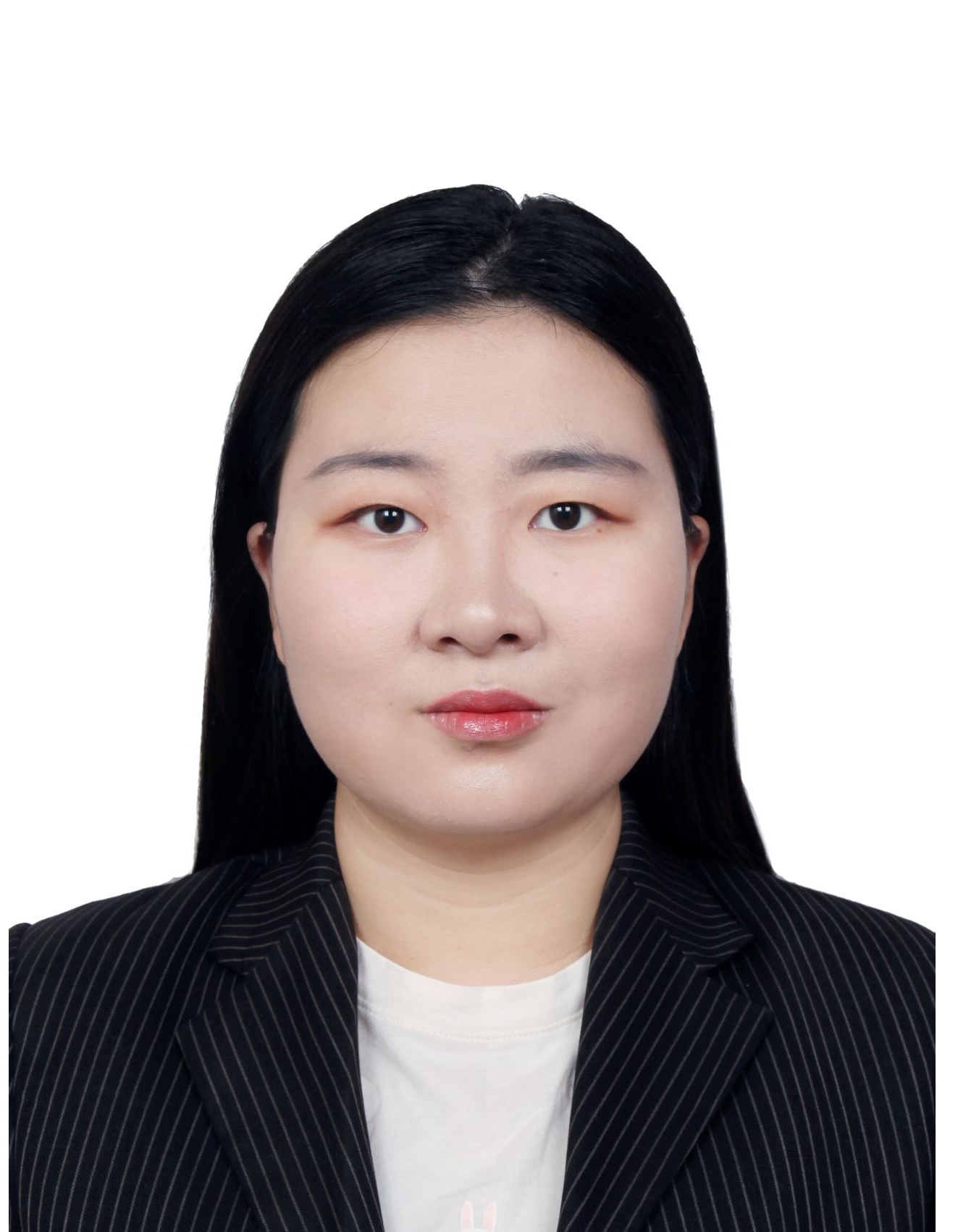
Masters Student
University of Melbourne
-
Saisree Sukruta Matta
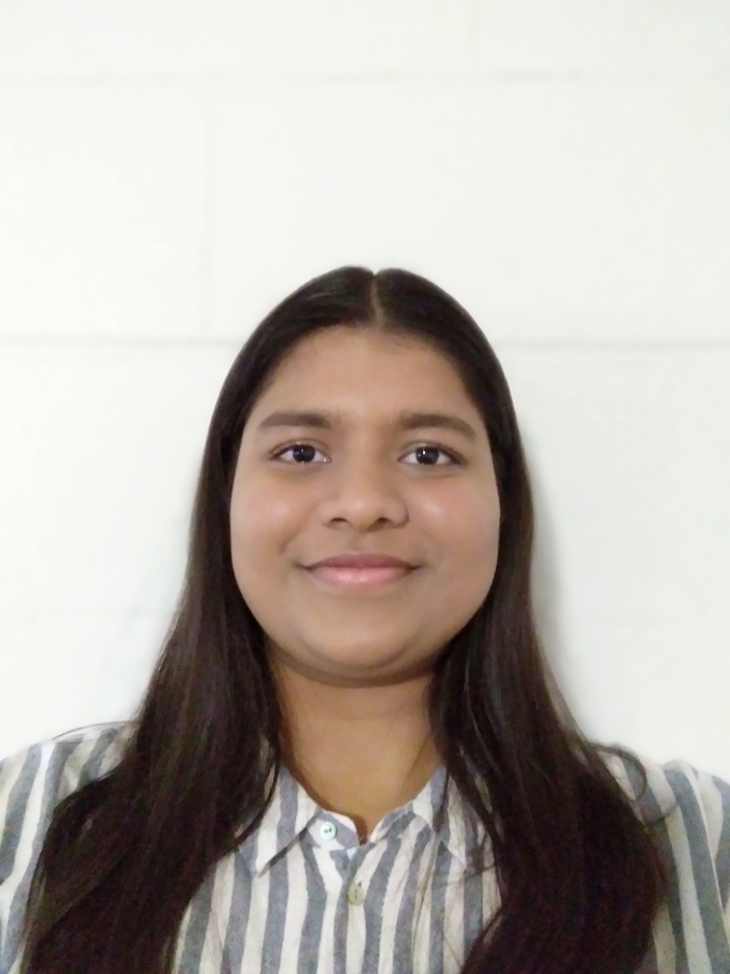
Masters Student
University of Melbourne
-
Hazel Altundal
Bachelors Student
University of Melbourne
-
Ivan Widjaja

Bachelors Student
University of Melbourne
-
Giulia Zanotto
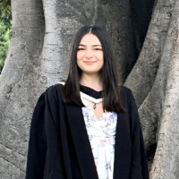
Masters Student
University of Melbourne
-
Patrice Ana Moloney

Research Assistant
University of Melbourne
Digital Lab
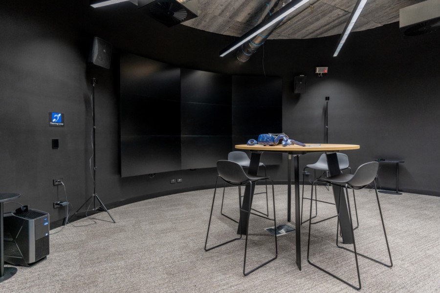
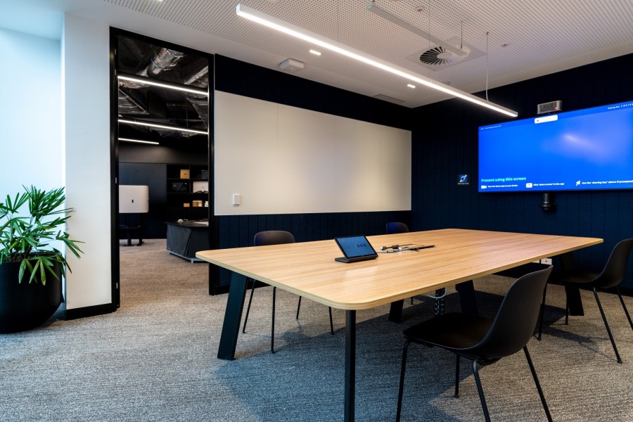
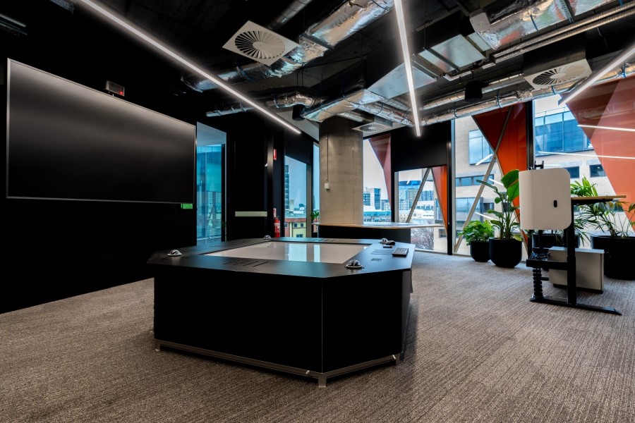
Digital Lab (D-Lab) is a technology arm of the Centre for SDIs and Land Administration (CSDILA) which provides advanced interactive data capturing, analysing, and visualisation tools and solutions to contribute to research, development, and teaching in a wide range of scientific disciplines such as computer science, engineering, physical sciences, health, planning and architecture. Located on Level 1 at Melbourne Connect, the D-Lab is equipped with the latest technologies and applications to capture and visualise data and develop cutting edge 3D technologies.
We are open for partnerships! Please contact us if you are interested in collaborating with us!
For more information, please visit: https://infrastructure.eng.unimelb.edu.au/digital-lab
Contact Details
Davood Shojaei
Senior Lecturer
Geomatic Engineering in Infrastructure Engineering Department
- Email shojaeid@unimelb.edu.au
- Find an Expert profile
- Google Scholar Google Scholar
- ResearchGate ResearchGate
- Floor 6
- Melbourne Connect
-
700 Swanston Street, Carlton, 3053, VIC
The University of Melbourne
